Below we provide full details for 2012 entry on the new MRes in Advanced Spatial Analysis and Visualisation (ASAV). The course reflects the current state of play in geographic, urban and architectural information systems with an emphasis on visualisation, analysis and modelling. Taught at the Centre for Advanced Spatial Analysis, home of digital urban, it is an innovative and exciting opputunity to study at UCL with a MRes acting as a pathway to a PhD or further career in ASAV.
Showing posts with label Augmented Reality. Show all posts
Showing posts with label Augmented Reality. Show all posts

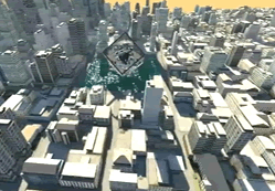
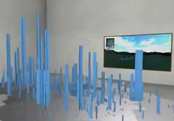
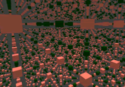
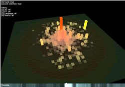
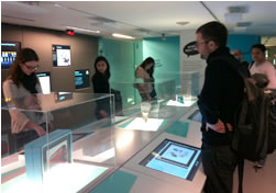
City in a Book: Augmenting the CityEngine
Over the past few days we have been working on a series of techniques to visualise and augment procedural cities.
.JPG)
If you add in a model of a BenQ projector, the MRes in Advanced Spatial Analysis and Visualisation Handbook, a city within the CASA logo and a webcam you get the following augmented reality:
We are exploring this as part of our digital visualisation module on the MRes here in CASA, aiming to build in the latest research into the lectures. The combination of Lumion, 3DMax, Illustrator, CityEngine and AR is intriguing...
.JPG)
If you add in a model of a BenQ projector, the MRes in Advanced Spatial Analysis and Visualisation Handbook, a city within the CASA logo and a webcam you get the following augmented reality:
We are exploring this as part of our digital visualisation module on the MRes here in CASA, aiming to build in the latest research into the lectures. The combination of Lumion, 3DMax, Illustrator, CityEngine and AR is intriguing...
Augmenting a Roman Fort: A Paper Model, IPad and Unity
Stuart Eve here at The Bartlett's Centre for Advanced Spatial Analysis has posted an update on his PhD research looking at augmenting archaeological sites. Before moving onto the real world he has built a proof of concept based on a Roman Fort made out of paper, the results on the iPad are extremely promising:
Augmenting a Roman Fort from Dead Men's Eyes on Vimeo.
Augmented Reality for 3D Max and SketchUp
Augmented Reality can be very impressive within office, museum and gallery based environments. It provides a hands on way to visualise cityscapes, architecture and urban animations displayed directly onto a physical desktop.
With the plugin for 3D from AR-Media it is also extremely easy to create:
We like the way all the animations are held with the file and move beyond the tag.
If you have not tried out tag based Augmented Reality yet then now is your chance as AR-Media also have a plugin for SketchUp:
Head over to http://www.inglobetechnologies.com/ to download the plugins. We have been working with AR for a while now and it really does offer a lot of 'bang for the buck'.
With the plugin for 3D from AR-Media it is also extremely easy to create:
We like the way all the animations are held with the file and move beyond the tag.
If you have not tried out tag based Augmented Reality yet then now is your chance as AR-Media also have a plugin for SketchUp:
Head over to http://www.inglobetechnologies.com/ to download the plugins. We have been working with AR for a while now and it really does offer a lot of 'bang for the buck'.
Museum Plaza - Louisville, Kentucky
The video below was produced for an exhibition featuring the proposed Museum Plaza building for Louisville, Kentucky.
We like the integration of the digital into the model footage, especially with the traffic. That said, the pixelated faces of the workers in the background is perhaps slightly concerning, especially for a clip to be used in an exhibition.
Building design by the Office for Metropolitan Architecture; video direction and production by Brooklyn Digital. Music by Mouse on Mars (via O.M.A.).
Museum Plaza from Brooklyn Digital Foundry on Vimeo.
We like the integration of the digital into the model footage, especially with the traffic. That said, the pixelated faces of the workers in the background is perhaps slightly concerning, especially for a clip to be used in an exhibition.
Building design by the Office for Metropolitan Architecture; video direction and production by Brooklyn Digital. Music by Mouse on Mars (via O.M.A.).
GIS and Augmented Reality in 2015
The last 12 months has seen a turning point in terms of bringing geographically aware augmented reality to mobile devices. Significant developments in locational technology such as the inclusion of a built-in digital compass, GPS (Global Positioning System) and accelerometers into mobile phones have allowed not only location but also heading, and pitch to be detected and therefore incorporated into data display systems. These built-in technologies have brought augmented reality to the hands of the masses, and the phones themselves have sparked a market driven boom in fusing augmented reality with location-based services (LBS).Currently applications are in their infancy and mainly focused on specific topics such as ‘show me where the closest x is’. This however represents the tip of the iceberg with the addition of a GIS into the mix there is notable potential for the industry.
The short paper below was written by Sung-Hyun Jang of the GIS and AR blog and us here at digital urban as part of a larger wide ranging technical report for the Association of Geographic Information which is coming out soon. You can read the short below via Issuu:
To keep up to date with all things GIS and AR, head over to Sung's GIS and AR blog.
The short paper below was written by Sung-Hyun Jang of the GIS and AR blog and us here at digital urban as part of a larger wide ranging technical report for the Association of Geographic Information which is coming out soon. You can read the short below via Issuu:
To keep up to date with all things GIS and AR, head over to Sung's GIS and AR blog.
Augmented (hyper)Reality
The latter half of the 20th century saw the built environment merged with media space, and architecture taking on new roles related to branding, image and consumerism. Augmented reality may recontextualise the functions of consumerism and architecture, and change in the way in which we operate within it:
The clip above was produced by Keiichi Matsuda a final year Masters in Architecture over at The Bartlett, here at University College London, as part of a larger project about the social and architectural consequences of new media and augmented reality.
Augmented (hyper)Reality: Domestic Robocop from Keiichi Matsuda on Vimeo.
The clip above was produced by Keiichi Matsuda a final year Masters in Architecture over at The Bartlett, here at University College London, as part of a larger project about the social and architectural consequences of new media and augmented reality.
Sketch Shapes in Augmented Reality - iPhone App (Hacked)
The excellent ReadWriteWeb site has a neat article on 'Devs Hack iPhone API for True Augmented Reality '
In short - take a look at the movie below and note the ability to draw shapes and then render via AR, complete with attached physics:
It has notable potential for designing buildings - see http://www.readwriteweb.com/ for more.
In short - take a look at the movie below and note the ability to draw shapes and then render via AR, complete with attached physics:
It has notable potential for designing buildings - see http://www.readwriteweb.com/ for more.
Augmented Reality: Urban Tagging via Messages and 3D Models
Augmented Reality on mobiles is currently without question one of the hottest research fields. A new application from Metaio is taking the concept a step forward allowing users to leave tweets, messages, web pages and 3D models in a real space for other users to view or pick up when there are in the vicinity.
This opens up a whole number of new development routes from augmented graffiti to leaving a virtual message outside someones apartment if they are out through to tagging locations, restaurants and services with virtual comments for users to view by simply pointing the mobile device at the location.
The application is currently under development for iPhone, Google Android, Windows Mobile and Symbian S60 platforms.
Picked up via VentureBeat.
This opens up a whole number of new development routes from augmented graffiti to leaving a virtual message outside someones apartment if they are out through to tagging locations, restaurants and services with virtual comments for users to view by simply pointing the mobile device at the location.
The application is currently under development for iPhone, Google Android, Windows Mobile and Symbian S60 platforms.
Picked up via VentureBeat.
EyePet PS3 & AR Toolkit for Flash
While not 'urban' this is caught our eye as a neat augmented reality application running on the PS3 via the PlayStation Eye. With the addition of a "magic card," players will be able to play with a virtual monkey that lives in augmented reality.
In many ways this could be done with ARTAG - see our Tutorial - Quick and Easy Augmented Reality from SketchUp/3DMax etc - but on a PS3 it takes it to the next level. Note the use of the trampoline towards the end of the clip and the nice use of shadows:
EyePet is due for a global release around the end of the year. It would be interesting to know if its possible to do something similar with ARTAG and Flash using the newly released AR flash library (see Hack A Day):
It is almost tempting to fire up our webcam and take a look, sadly we are interviewing for the rest of the day....
In many ways this could be done with ARTAG - see our Tutorial - Quick and Easy Augmented Reality from SketchUp/3DMax etc - but on a PS3 it takes it to the next level. Note the use of the trampoline towards the end of the clip and the nice use of shadows:
EyePet is due for a global release around the end of the year. It would be interesting to know if its possible to do something similar with ARTAG and Flash using the newly released AR flash library (see Hack A Day):
It is almost tempting to fire up our webcam and take a look, sadly we are interviewing for the rest of the day....
Augmented Reality with the Sauerbraten Game Engine
In the clip above the Sauerbraten game engine is used to render a game map in real time onto a video feed. The game is run in multiplayer mode and one of the characters can be seen walking around.
We especially like the concept of holding a multi-player game map in your hand, to such an extent that we have suddenly got an urge to hold all of those little people from Populous in our hands via AR...
Take a look at the AliveTeam channel on YouTube for more movies.
TwitARound: Augmented Reality Tweets in the City
TwittARound is an augmented reality Twitter viewer on the iPhone 3GS. It shows live tweets around your location on the horizon with the video see-through effect allowing you to see where the tweet comes from and how far it is away:
Download Squad, where we picked it up from, didn't seem to see the point, we think its an incredably intriguing view of the cityscape - to be able to pan around a area and see the live tweets is perhaps a glimpse into the 'X-Ray Datascape' city of the future?
See TwittARound for more info.
Download Squad, where we picked it up from, didn't seem to see the point, we think its an incredably intriguing view of the cityscape - to be able to pan around a area and see the live tweets is perhaps a glimpse into the 'X-Ray Datascape' city of the future?
See TwittARound for more info.
Parallel Tracking and Mapping on the iPhone: Augmented Reality App Development
The porting of Augmented Reality to mobile devices has notable implications for data distribution and navigation in the city. Georg Klein, a post-doctoral research assistant in the Active Vision Group of the Oxford University Engineering Department, has posted his results developing 3D Augmented Reality (AR) on the iPhone. The clip details an adaptation of the parallel tracking and mapping system to an iPhone:
Georg notes that it still needs a lot of work - the camera's narrow field-of-view is problematic - but they can already make and track small maps. Of note is the use of the iPhone 3G rather than the 3GS with the built in compass see
http://www.robots.ox.ac.uk/~gk for full details and past projects.
Thanks go to Greg Downing for the link, anyone interested in panoramas and 3d modelling techniques should take a look at his work via http://www.gregdowning.com/
See also Augmented Reality for Android: GIS in the City and Location Based Augmented Reality for Android: Enkin
Georg notes that it still needs a lot of work - the camera's narrow field-of-view is problematic - but they can already make and track small maps. Of note is the use of the iPhone 3G rather than the 3GS with the built in compass see
http://www.robots.ox.ac.uk/~gk for full details and past projects.
Thanks go to Greg Downing for the link, anyone interested in panoramas and 3d modelling techniques should take a look at his work via http://www.gregdowning.com/
See also Augmented Reality for Android: GIS in the City and Location Based Augmented Reality for Android: Enkin
Worlds First Mobile Augmented Reality for Android: GIS in the City
Combine GIS with mobile devices equipped with a digital compass and GPS and what do you get? Datascapes that can be mapped and layered on top of any object in the city, the potential for moving GIS and locational based services direct into the field is to be honest huge and now the first service has launched in the Netherlands via SPRXmobile. Known as Layar, it is the worlds first mobile Augmented Reality browser, which displays real time digital information on top of reality (of) in the camera screen of the mobile phone.
While looking through the phone’s camera lens, a user can see houses for sale, popular bars and shops, jobs, healthcare providers and ATMs. The first country to launch Layar is The Netherlands. Launching partners are local market leaders ING (bank), funda (realty website), Hyves (social network), Tempo-team (temp agency) and Zekur.nl (healthcare provider).
How it works
Layar is derived from location based services and works on mobile phones that include a camera, GPS and a compass. Layar is first avaliable for handsets with the Android operating system (the G1 and HTC Magic). It works as follows: Starting up the Layar application automatically activates the camera. The embedded GPS automatically knows the location of the phone and the compass determines in which direction the phone is facing. Each partner provides a set of location coordinates with relevant information which forms a digital layer. By tapping the side of the screen the user easily switches between layers. This makes Layar a new type of browser which combines digital and reality, which offers an augmented view of the world.
ARhrrrr! Augmented Reality Mobile Phone Gaming
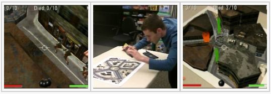
ARhrrrr is an augmented reality shooter for mobile camera-phones from the Augmented Environments Lab. The phone provides a window into a 3d town overrun with zombies. Point the camera at our special game map to mix virtual and real world content. Civilians are trapped in the town, and must escape before the zombies eat them! From your vantage point in a helicopter overhead, you must shoot the zombies to clear the path for the civilians to get out. Watch out though as the zombies will fight back, throwing bloody organs to bring down your copter. Move the phone quickly to dodge them. You can also use Skittles as tangible inputs to the game, placing one on the board and shooting it to trigger an explosion:
By merging graphics with props in the physical world, handheld Augmented Reality games pull the player through the small screen and into a larger merged play-space. Take a look at the project page for more info...
If you want to start experimenting yourself see our Quick and Easy Augmented Reality Tutorial.
Thanks go to Marek for sending us the link via Engadget.
Augmented Reality for SketchUp: Now on the Mac
We ran a post on ARMedia a while ago and now the Augmented Reality plugin for SketchUp is available for the Mac. The movie below sums up the possibilities:
If you are in the business of communicating designs to clients or setting up an exhibition space and need something that little bit different then augmented reality carries a large wow factor for very little effort.
You can download a free trial from http://www.inglobetechnologies.com/en/products/arplugin_su/info.php
If you are in the business of communicating designs to clients or setting up an exhibition space and need something that little bit different then augmented reality carries a large wow factor for very little effort.
You can download a free trial from http://www.inglobetechnologies.com/en/products/arplugin_su/info.php
ARSights: Augmented Reality for Google Earth
Augmented Reality is one of those technologies that is very impressive yet simple to implement. Thanks to the Development Lab of Inglobe Technologies its just got easiy via their Web-Based Tool that allows users to visualize Google Earth 3D models using Augmented Reality.
Take a look at the movie below:
While ARSights is not Augmented Reality directly inside of Google Earth, it acts a browser for models that in turn can be visualized directly on users’ desktop, by connecting a simple webcam and by printing a suitable code.
Take a look at http://www.arsights.com/ for more info.
Take a look at the movie below:
While ARSights is not Augmented Reality directly inside of Google Earth, it acts a browser for models that in turn can be visualized directly on users’ desktop, by connecting a simple webcam and by printing a suitable code.
Take a look at http://www.arsights.com/ for more info.
Augmented Reality in (outside) of Second Life
As we have pondered in various posts Augmented Reality is a quick win in terms of visualisation, it is realtivly easy to implement and has a high 'wow' factor. The concept is simple, a webcam is linked up via a toolkit that is able to identify printed tags, the system then superimposes and 3D model over the scene - thus augmenting reality.
Of course the printed tags dont have to be 'physical' they can be embedded into Virtual Worlds such as Second Life, creating a really unqiue concept of importing/moving and visualisation objects in a virtual environment.
Take a look at the video below from cristiancontini for a really interesting proof of concept:
Augmented Mixed Reality: Second Life pops out from the Screen from cristiancontini on Vimeo.
See http://www.hitl.washington.edu/artoolkit/ for download and working examples.
See also our recent posts on Papervision Augmented Reality and Augmented Reality for Architecture using SketchUp.
Of course the printed tags dont have to be 'physical' they can be embedded into Virtual Worlds such as Second Life, creating a really unqiue concept of importing/moving and visualisation objects in a virtual environment.
Take a look at the video below from cristiancontini for a really interesting proof of concept:
Augmented Mixed Reality: Second Life pops out from the Screen from cristiancontini on Vimeo.
See http://www.hitl.washington.edu/artoolkit/ for download and working examples.
See also our recent posts on Papervision Augmented Reality and Augmented Reality for Architecture using SketchUp.
Augmented Reality and Google SketchUP: ARplug-in

We have always been big fans of augmented reality here at digital urban, simply because it is so easy to set up yet a very impressive and powerful visualisation technique. As such the ability to export direct from Google SketchUp via the new plugin ARplug-in from the Development Lab of Inglobe Technologies, into a physical space has huge potential - see the movie below:
All you need to make ARplug-in work is a personal computer, a webcam and a printed code attached to the software.
For optimal functionality, a Dual-core PC with a standard graphic card for 3D videogames are recommended, see AR-media for full details and download.
A free demo version is available with the full version coming in at 99 euros.
Papervision Augmented Reality
Augmented Reality is possibly one of most impressive techniques to implement compared to time and level of technology required. Sadly the recent uncertainty surrounding ArTag has left a hole in the community with the tool kit waiting for a decision on licensing.
As such its exciting to see an example of augmented reality running in Flash via Papervision, the movie below provides an insight:
Papervision - Augmented Reality (extended) from dpinteractive on Vimeo.
Keep an eye on http://interactive.digitalpictures.com.au/ for more updates..
As such its exciting to see an example of augmented reality running in Flash via Papervision, the movie below provides an insight:
Papervision - Augmented Reality (extended) from dpinteractive on Vimeo.
Keep an eye on http://interactive.digitalpictures.com.au/ for more updates..
Subscribe to:
Posts (Atom)


